
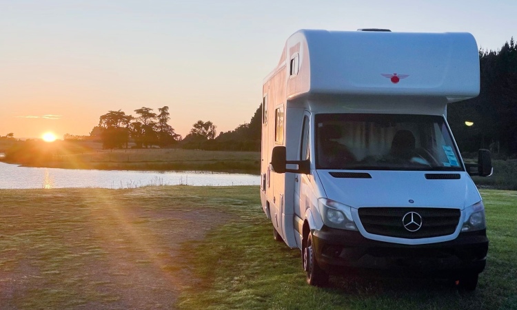
How did the islands of Aotearoa New Zealand come into being? Where did the first people arrive from? How long did it take Europeans to rediscover these South Pacific islands? How would you plan to tackle exploring New Zealand from a camper van or motorhome? What areas might be of interest to travellers looking for different things, and what are the highlights within them? This blog provides possible answers to these questions and simultaneously serves as an index to our own explorations. It is one that we will revisit and update as our journey progresses. Perhaps the Curiosity Drive blob map will prove useful for your own planning? Please let us know if there are places in your area/ travels that you feel we shouldn’t miss.
The first inhabitants
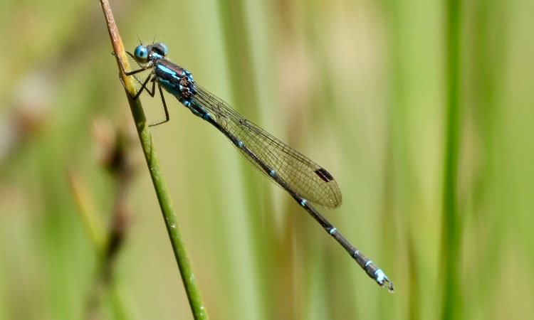
100,000,000 years ago the southern hemisphere’s supercontinent of Gondwana began breaking apart. During the middle Cretaceous period (when dinosaurs ruled), the eastern edge broke off to become Zealandia, isolating unique plants and animals on lands closer to the South Pole than present-day NZ. 66,000,000 years ago Zealandia’s dinosaurs went extinct—as elsewhere on the planet—due to a catastrophic asteroid impact. In most of the world, mammals evolved to fill niches formerly occupied by dinosaurs, but seemingly not in Zealandia. It’s believed there were no land mammals in NZ at the time it was first settled by humans (bats arrived relatively recently from Australia), so if they had been present at some point in Zealandia, it’s not clear what became of them. The lack of mammals allowed birds to become dominant and evolve in the absence of predators (some becoming flightless). Plate tectonics, volcanism and climate change (glaciation) also further shaped and re-shaped Zealandia and the plants and animals adapting to life there.
For an alternative cultural explanation of the origin of these islands, see our synopsis of Māui’s fishing trip here.
Human discovery and rediscovery
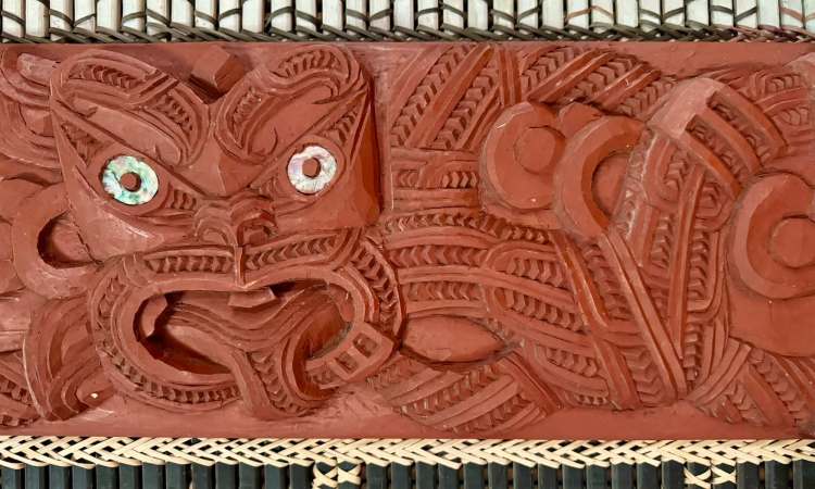
The first people to in arrive in the islands now known as New Zealand were not the Polynesian demigods spoken of in oral histories. The islands of the Pacific were explored and settled over the course of some 5,000 years by peoples from South East Asia, who devised ocean-going waka (canoes) and systems of navigation that extended their reach. This enabled these early Polynesians to reach Hawaii in the north and Rapa Nui/ Easter Island in the east; they developed distinct cultures as they migrated westward. Some voyagers found their way south from around 1300 AD, although what prompted this—and whether it was accidental or intentional—is subject to speculation. Māori oral traditions speak of fleets of waka arriving from Hawaiki, the legendary/ spiritual homeland of several Polynesian cultures. Hawaiki may refer to multiple islands around modern-day Tahiti or Rarotonga; multiple waves of migration are considered likely. There is no archaeological evidence of return voyages, so it must have been a one-way trip. As elsewhere in Polynesia, the settlers developed a distinct culture (and tribal sub-cultures) that we recognise today as Māori*, reflecting new landscapes (e.g. mountains), a cooler climate and different natural resources (e.g. flightless birds).
*Māori means “ordinary”; in the absence of an indigenous national identity, the term was used by Māori to distinguish themselves from non-indigenous Europeans, whom they called Pākehā.
The Moriori.
🤔 Curiosity
At one time it was taught that the Moriori had settled New Zealand before the Māori, who displaced them. Current thinking is that these original settlers of Rēkohu and Rangihaute (Chatham Islands; ~800km southeast of mainland NZ) had re-migrated from the mainland, although oral traditions also describe settlement direct from eastern Polynesia. Some time after multiple arrivals from 1500 AD, conflict on the islands was ended by covenant (Nunuku’s Law): there was to be no more murder, warfare, or cannibalism. However, in 1835 two Taranaki-based Māori iwi/ tribes invaded peaceful Rēkohu and enslaved or killed much of the Moriori population, who had no culture of resistance—an act of genocide in modern eyes. The unique Moriori culture nevertheless endured.
The first Europeans to sight New Zealand were the Dutch, with explorer Abel Tasman’s arrival in Golden Bay, in 1642. Tasman’s brief meeting with local Māori ended with bloodshed on both sides, and he sailed off along the west coast of North Island without appreciating the true nature of the lands and people he had encountered.
In 1769—127 years later—another European ship arrived in New Zealand waters; the HMS Endeavour, commanded by James Cook. Officially on a scientific mission, another objective of Cook’s voyage into the Southern Ocean was to uncover a suspected southern continent—and claim it for Great Britain. Cook made three Pacific voyages in all, having recruited a Tahitian navigator on his first trip who was able to communicate with Māori. Predictably, despite some level of cultural interpretation, there were also violent encounters. Sealers and whalers began visiting New Zealand waters in the 1810s, and by the 1830s introduced communicable diseases and muskets (which accelerated inter-tribal warfare) had significantly reduced the Māori population. In this context, New Zealand became a British colony in 1840, when the Treaty of Waitangi was signed between the British Crown and various Māori chiefs, marking the beginning of British sovereignty.
For more on NZ history, check out the RNZ podcast The Aotearoa History Show.
Naming a new land.
🤔 Curiosity
In 1642 the Dutch explorer Abel Tasman originally named the land that was to become know as New Zealand Staete Landt, meaning “Land of the Governors (of the Dutch Republic)”. However, upon receiving Tasman’s journal, the Dutch East India Company gave it the Latin name of Zelandia Nova in reference to the Dutch province of Zeeland (so Nieuw-Zeeland in Dutch). English explorer James Cook called the country he charted in 1769–70 Newzeland. English writers often spelt the Dutch province as Zealand, so both New Zeeland and New Zealand were in use—until the latter was settled upon in the early 19th century. More recently, Aotearoa has been introduced as a Māori language name for the country (Māori traditionally named only individual islands, and it may have referred to North Island at one time, but Māori did not name island groups). Thus, the contemporary name is often written as Aotearoa New Zealand, which is an unofficial designation. There have been calls to drop the “New Zealand” bit entirely.
How to tackle exploring New Zealand
So, how would you (re-)discover Aotearoa New Zealand? This was a challenging question we faced as we began planning for an 18-month road trip. As a starting point, we figured we’d take the advice we have repeated to others planning shorter trips:
Spend two thirds of your time in South Island, one third in North Island.
Conventional wisdom
But that alone would hardly be sufficient, being a little light on detail! There would be other considerations too:
- Flexibility: At the other extreme, how much of a plan would we need, if the idea was to be spontaneous and free ourselves from the constraints and stress of a carefully crafted schedule? Having some flexibility would allow us to stay longer at places we liked, and to move on from places we didn’t care for.
- Crossings: Taking a motorhome between the North and South islands involves a ferry. Despite being a nation of islands, the fragile nature of ferry services in New Zealand has recently been highlighted via multiple breakdowns and cancelled sailings. Nor are they cheap. Minimising ferry use made sense.
- Seasons: Generally temperate, seasons here are opposite to those in the Northern Hemisphere: Summer is Dec–Feb; Autumn Mar–May; Winter Jun–Aug; and Spring Sep–Nov. North Island is generally warmer, and South Island gets more snow—so where should we spend the winter months? We had to be able to flex to escape adverse weather (e.g. two cyclones in our first few months).
- People: With family here and the potential of meeting up with visiting friends, how much time do we spend “at home” for events like Christmas and birthdays, and how much emphasis do we put on major attractions that visitors might wish to see with us—while still leaving room for our own exploration of “in between” places”?
- Events: Even if few in number, there are certain events being held in various places we’d like to attend if feasible. Marking those in the calendar helps us decide if attending will be an option—or whether we adapt the plan it make it so. Long distance driving (and public transport) in NZ isn’t as simple as it is in many countries. This could include holidays away from the van.
The bottom line is that we don’t have a fixed plan. Some days we don’t know where we’ll be sleeping that night, but we do typically have a “general direction”. That direction is based on the following overall strategy, initiated months before we arrived in New Zealand:
- Division: We looked at NZ maps and newzealand.com in order to group attractions/ landscape features into simplified regions/ areas of interest. Looking at a full map with all the place names, administrative divisions and road networks included is just too intimidating.
- List making: We used Notes (a macOS/ iOS app) to make lists of all the things we might wish to see/ do/ experience is each of those areas. We collated tips from YouTube videos, took recommendations from other people, looked over photos from our previous trips, read things on the web… until we had respectable lists for each area.
- Area guides: We used Apple Maps to create a Guide corresponding to each area, and populated each guide with the coordinates of all the things we had accumulated in Notes (where possible). These guides would synch to our phones, which we anticipated using for navigation, thus making getting to points of interest that bit easier. As “living maps” we would be able to add (or remove) points of interest as we learned more about them. With all the points in an area displayed relative to one another and our current position, there would be a natural sequence for setting them as a destination.
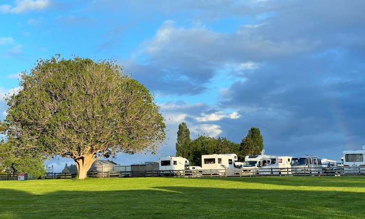
- Blob map: The next step was to recreate a simple overview map with our areas of interest depicted as “blobs”—one for each Guide within Apple Maps. The main function of this map (shown below) was to support decision making about our route. Do we go east or west, or through the middle? Which blob is best in which season? Is there a natural order that minimises unnecessary travel (ferry crossings, fuel costs, etc.)?
- Wall planner: Referencing the blob map, we now had a working batting order that set our direction of travel. On it we indicate in which blob we expect to be, by week. It’s not final, but a starting point. It would permit flexibility (named blobs are attached with Blu-Tack, so are readily movable), but also spoke to an inherent fear that we might not get around to visiting all the places we wanted to get to. Essentially, all the pieces were on the board, which we can rearrange on a whim.
So that’s been our approach. Now to introduce you to what is in each blob—and specifically, to index mission logs that pertain to each, as explored to date (if there are no logs below a synopsis, we’ve not managed to get there yet). A POI Map button signposts to key points of interest that we used to plan visits.
North Island blobs
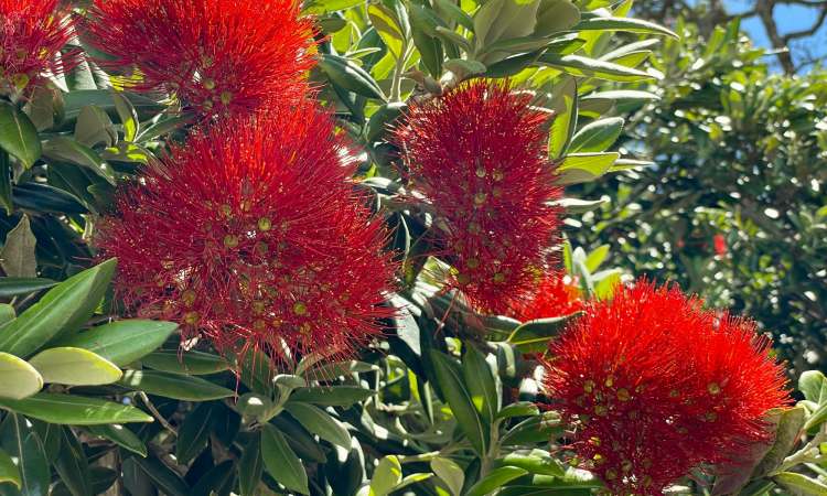
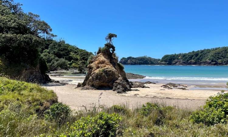
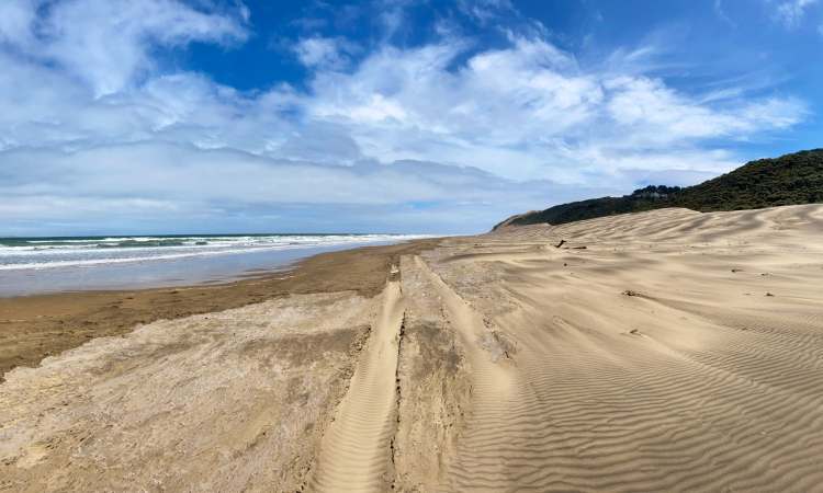
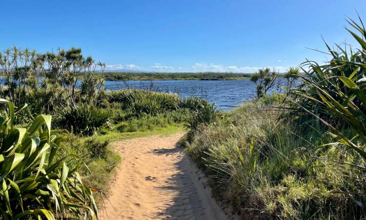
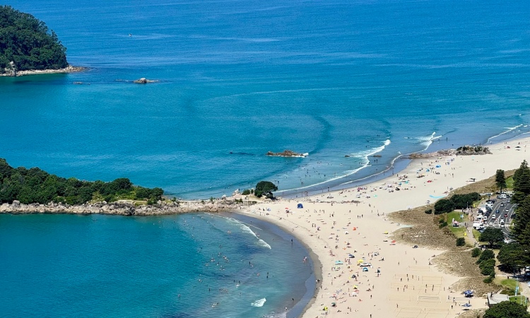
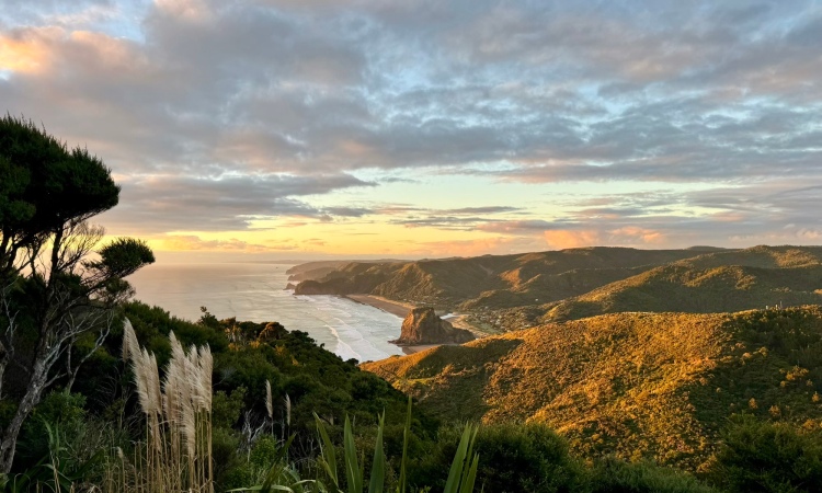
Northland: With a sub-tropical climate, the so-called “Winterless North” is home to many awesome sandy beaches, including those offered by the popular tourist destination of Bay of Islands (140+ islands offering a range of water-based activities e.g. swimming with dolphins). It’s also where our NZ-based family relocated, thus the main population centre of Whangārei city serves us as “home base”. It has a strong Māori identity, with many significant historical and cultural sites, such as the Waitangi Treaty Grounds. The region saw the founding of the first permanent European settlement in Russell. Northland is also known for fresh kaimoana (seafood/ shellfish) and for ancient kauri trees—some of which are over 1,000 years old (e.g. in the Waipoua Forest).
Auckland: The largest urban centre (around 1.4 million), the “City of Sails” is also now popularly referred to as Tāmaki Makaurau (an electoral zone since 2002). B grew up in the South Auckland countryside (Clevedon). Auckland has a diverse population, with a mix of European, Asian, Māori, and Pasifika (Pacific Islander) communities attracted by a mild climate and Big City opportunities (house prices are horrendous, however). With a harbour either side and numerous islands in the vicinity, the area is ideal for outdoor activities. Auckland has a distinct food and wine scene, with numerous farmers markets, vineyards and restaurants serving fresh local produce. It boasts a range of cultural attractions (e.g. Sky Tower) as well as popular parks and gardens (e.g. Auckland Botanical Gardens). As a hub for international travel, Auckland Airport often serves as the gateway to New Zealand.
Coromandel: This peninsula on the east coast is actually part of the Waikato region (see below), although has its own “relaxed” vibe with stunning beaches and rugged landscapes. Tourists flock to popular sites such as Cathedral Cove (a rock arch located on a gorgeous beach) and Hot Water Beach (where geothermal activity heats pools of water you dig out in the sand). There are several quirky/ quaint towns (e.g. Thames, Coromandel Town and Whitianga) and smaller settlements, many of which owe their existence to gold mining. Hiking, bird watching and eco-tourism are good reasons to visit the northern end of the peninsula. Ordinarily accessible, Cyclone Gabrielle in early 2023 demonstrated how fragile the Coromandel road network is—and the harmful (not to mention unsightly) impacts of the logging industry.
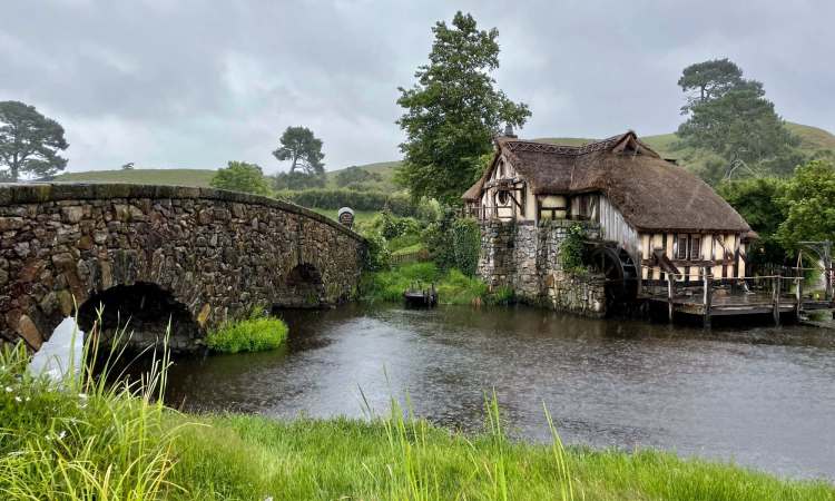
Waikato: The Waikato is the largest region in North Island (25,000 square kilometres); the “Mighty Waikato” is NZ’s longest river. The region is known for its fertile farmland with a strong agricultural industry (especially dairy production), rolling hills and beautiful natural landscapes. The Waikato is home to several significant cultural and historical sites, including the Waitomo Caves (popular for their underground glowworms), the Hamilton Gardens (a themed garden complex), and the Hobbiton Movie Set (for The Hobbit/ Lord of the Rings fans). The city of Hamilton is the hub for arts and culture, with a range of museums, galleries, theatres and festivals.
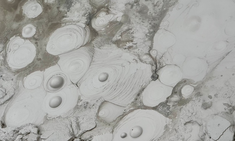
Rotorua: Part of the Bay of Plenty region (and often a gateway to it; see below), the city and area around Rotorua is known for its unique geothermal activity, including geysers, hot springs and mud pools. Several natural (e.g. Wai-O-Tapu Thermal Wonderland; the Redwood Forest) and cultural (e.g. Tamaki Maori Village; the Te Puia cultural centre) attractions appeal to visitors. Adventure tourism/ adrenaline sports are also popular, such as mountain biking, white water rafting, skydiving, and ziplining. Rotorua has several picturesque lakes, including Lake Rotorua, which offers fishing, water sports, and scenic boat cruises. The city has a range of galleries, museums, and festivals.
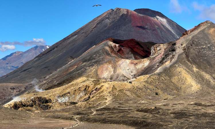
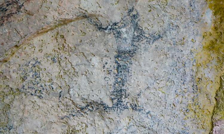
Taupo: Part of Waikato region (see above), Taupō itself is a small town located next to a large lake—the largest in NZ. Lake Taupō fills a volcanic caldera, formed in a eruption about 27,000 years ago—believed to have been one of the most violent in Earth’s history. The lake is surrounded by the volcanos of Tongariro National Park and visitors come to take in the region’s geothermal sights and activities through soaking in hot springs, skydiving, bungee jumping, jet boating, and hiking (most notably, it is a popular base for undertaking the amazing Tongariro Alpine Crossing). Taupō’s cultural attractions include the Māori rock carvings on Lake Taupō and a range of cultural experiences.
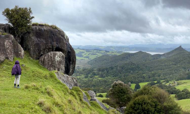
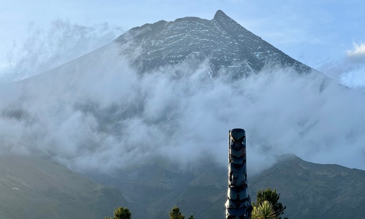
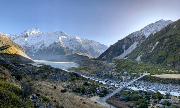
Ruapehu: Part of the Manawatū-Whanganui region (see below), Ruapehu is an active stratovolcano and is the highest point on North Island at 2,797m. Located within Tongariro National Park, the volcano is surrounded by forests, lakes, and other snow-capped mountains. Ruapehu itself has two major ski resorts on its slopes (Whakapapa and Turoa). The Tongariro Alpine Crossing (within Tongariro National Park) includes views of the volcanic peaks of Tongariro, Ngauruhoe, and Ruapehu; it is considered one of the best day hikes in NZ.
Bay of Plenty: Often abbreviated to BOP, this coastal region (along with parts of Gisborne region) extends into an ill-defined “East Cape” area; these parts of the region may thus be described as within “Eastland” (see Gisborne, below). Known for stunning beaches, a sunny climate, and fertile farmland (kiwifruit, avocado and citrus are major crops), BOP includes several popular holiday destinations, such as the coastal towns of Tauranga and Mount Maunganui; Whakatāne is another major population centre.
Gisborne: The wider Gisborne/ Poverty Bay area, north to the actual East Cape, is sometimes referred to as “Eastland” (which is sometimes taken to include the greater “East Cape” area, possibly even the BOP parts!). Gisborne itself is the easternmost city in New Zealand (and the first city anywhere to see the sunrise each day). The region is renowned for wine production, especially Chardonnay, and Mount Hikurangi is popular with hikers.
Hawke’s Bay: Sitting below “Eastland”, this agricultural region is also renowned for its wine production, especially red varieties (e.g. Merlot, Cabernet Sauvignon, and Syrah). The main cities of Hastings and Napier are located on the Heretaunga Plains. The latter city was rebuilt following a devastating earthquake in 1931, so is a go-to destination for fans of art deco style. Natural attractions include the rugged Cape Kidnappers coastline, Te Mata Peak, and the Mohaka River.
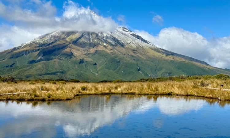
Taranaki: The region is dominated by Mount Taranaki (Egmont), a dormant volcano with a distinctive symmetrical cone rising to 2,518 metres. Taranaki has several beautiful beaches and coastal towns, including New Plymouth which is a cultural hub for the region. The Forgotten World Highway is a 3 hour scenic drive (148km) from Stratford in Taranaki to Taumarunui in the King Country.
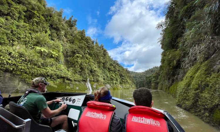
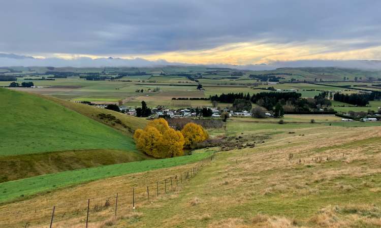
Manawatū–Whanganui: Characterised by rugged landscapes, winding rivers and fertile plains, the major population centres in this region are Palmerston North and Whanganui. Farming and forestry are the main industries; tourist highlights include hiking in Te Āpiti – Manawatū Gorge and activities on/ along the Whanganui River.
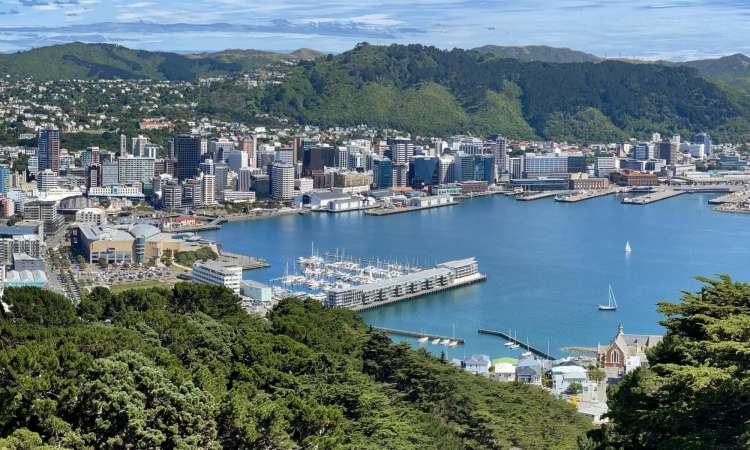
Wellington: The Eye of the Fish, the City on the Edge, Wellington is the capital city. “Windy Welly” incorporates a picturesque harbour set within a surrounding hilly landscape; we lived and worked here during 2006–07 and consider it a special place. It offers numerous cultural institutions including museums, theatres, art galleries, etc. The city is known for its food and beverage scene, with plenty of restaurants, cafés, and bars to choose from. Wellington is home to the government and parliament and with a diverse community, is known for progressive politics and social attitudes. Key attractions include Te Papa (the national museum), Mt. Victoria, Oriental Bay, the Zealandia wildlife sanctuary, the Cable Car/ Botanic Gardens, and further from the CBD, Mākara Beach and the Kāpiti Coast. Wellington has an international airport and a ferry port for reaching South Island.
Wairarapa: Part of Greater Wellington (also known as the Wellington Region), the eastern side of the lower North Island is much less densely populated; the main town is Masterton. Reached by crossing the Rimutaka Range, the small towns of Martinborough and Greytown are known for their colonial architecture and boutique shopping. The Wairarapa has a strong agricultural industry, but the region is best known for wine production. The Cape Palliser coastline is a popular attraction, with a lighthouse, seal colony and scenic drives.
South Island blobs
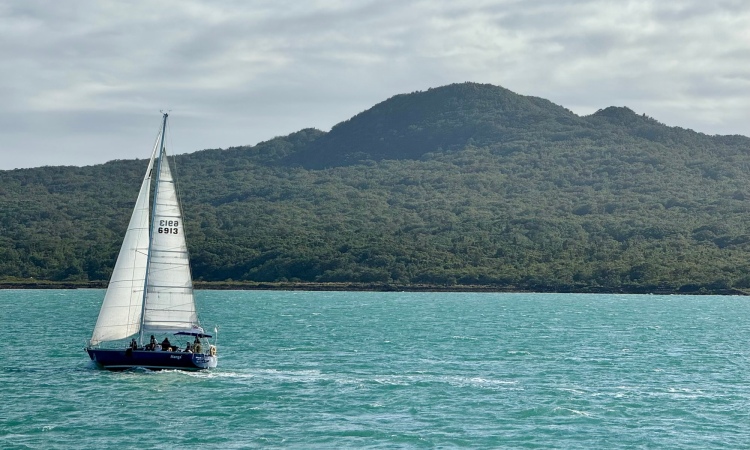
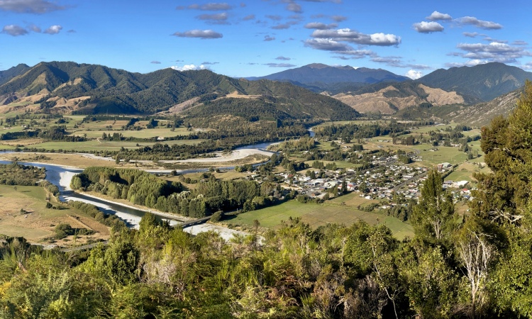
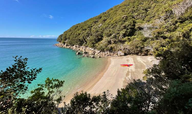
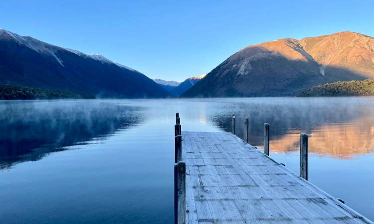
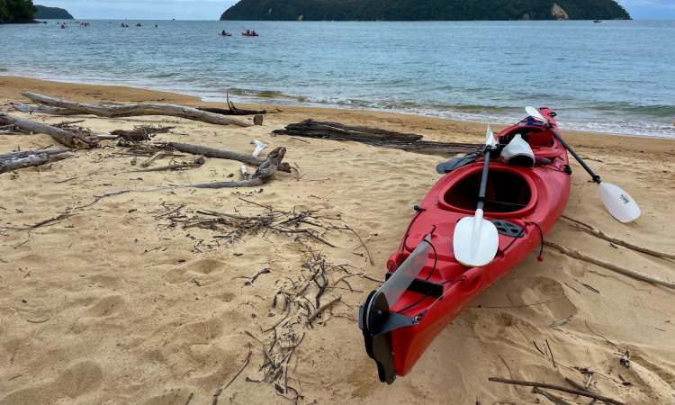
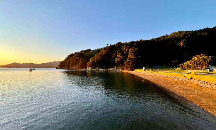
Tasman: While the principal town of Richmond is less well known, the Tasman region boasts three national parks: Abel Tasman, Kahurangi, and Nelson Lakes. The coastal areas have a Mediterranean-like climate and are popular for outdoor activities such as swimming, sailing, kayaking, and fishing. The region is home to many vineyards and wineries, as well as breweries and distilleries, making it popular among food and drink enthusiasts.
Nelson: Nelson city is located in Tasman Bay and is known for its vibrant arts and culture scene, with a range of institutions such as museums, galleries, and performing arts venues. Nelson is renowned for its sunny climate, with long hot summers and mild winters. It has a thriving food and beverage scene, with many restaurants, cafés, craft breweries, and wineries.
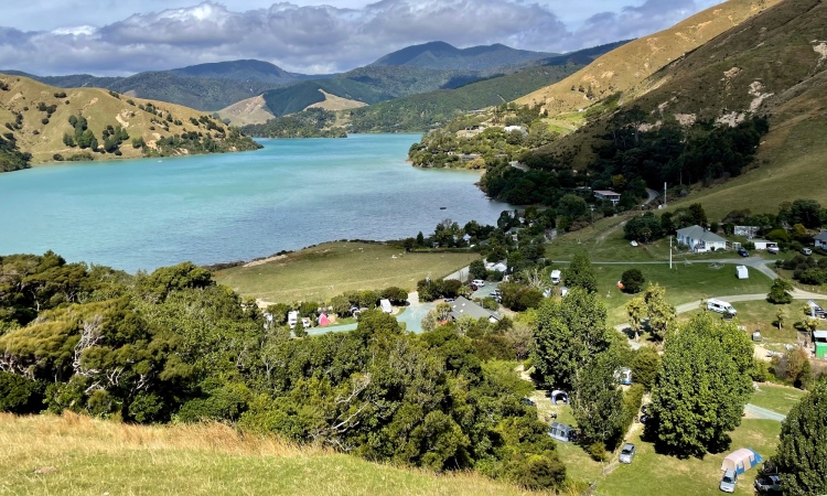
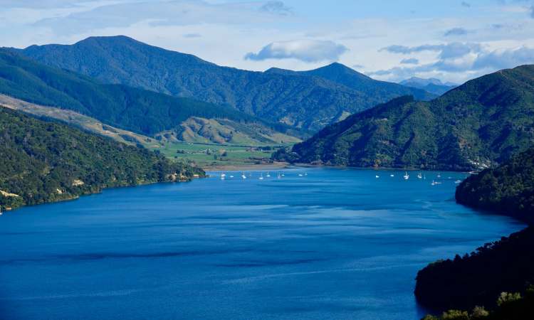
Marlborough: New Zealand’s largest wine growing region, famous for Sauvignon Blanc, Chardonnay, and Pinot Noir wines. Hiking (e.g. the Queen Charlotte Track), fishing and boating are popular in the Marlborough Sounds given their pristine waters, secluded bays, and sea life such as dolphins, seals, and penguins. The region’s largest town, Blenheim, is known for boutique shopping, weekend markets, and an annual wine and food festival.
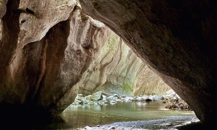
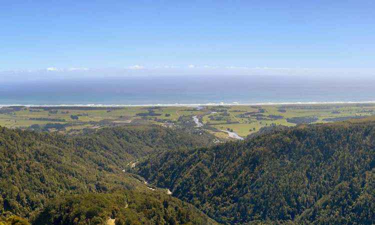
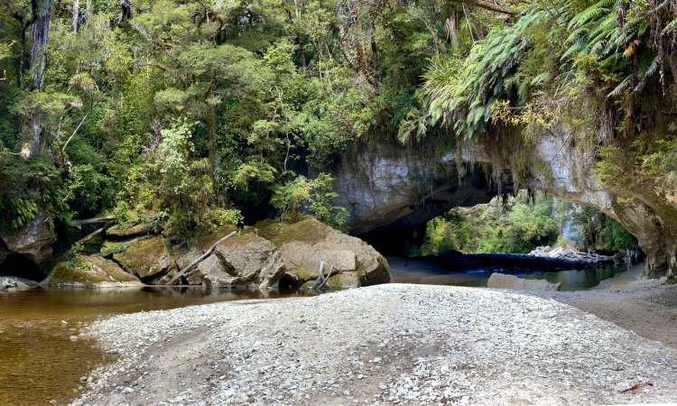
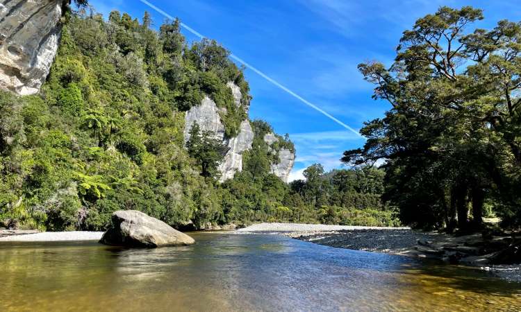
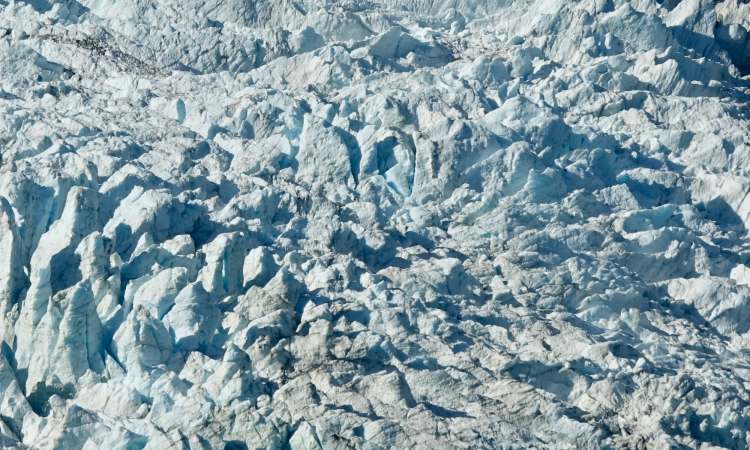
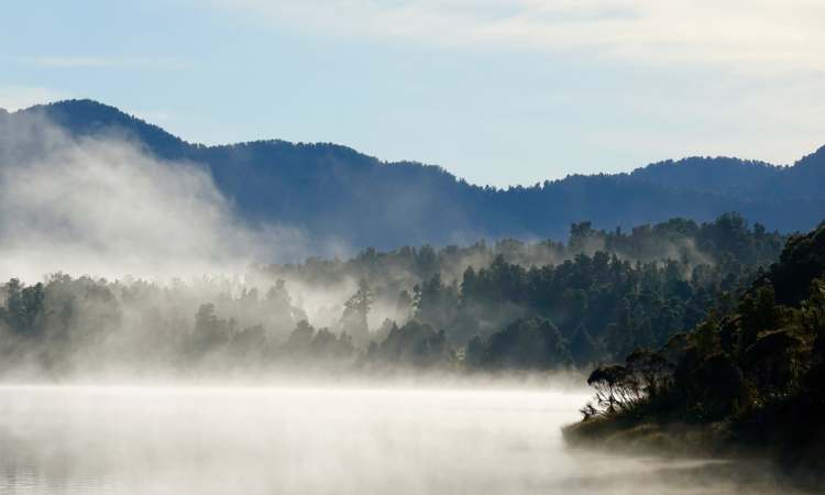
West Coast: This region on the west coast of South Island is known for its rugged and wild natural beauty, including the Southern Alps and adjacent rainforest. The principal towns are Westport, Greymouth and Hokitika. Gold mining began in the late 1800s and played a major role in shaping this part of NZ, which is home to several unique and endangered species of flora and fauna, including the great spotted kiwi and the Westland petrel. The West Coast has a strong sense of cultural identity, with a significant Māori population and a rich history of pioneer settlement. Outdoor activities include hiking, kayaking, mountain biking, skiing, and glacier tours. Popular destinations are Glacier Country (the Franz Josef and Fox glaciers), Punakaiki’s Pancake Rocks, Hokitika Gorge, and the historic gold-mining town of Shantytown.
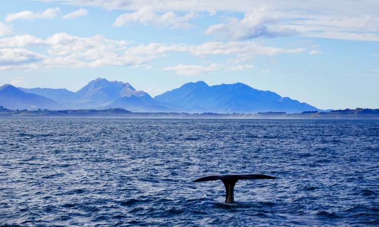
Canterbury: The wider Canterbury region (the largest in NZ at 45,346 square kilometres) is renowned for outdoor activities, including skiing, hiking, mountain biking, rafting, and whale watching. It has a diverse agricultural industry, with sheep and dairy farming being the primary industries, but also including crops such as grain, fruit, and vegetables. The Canterbury Plains, which cover much of the region, are considered the breadbasket of NZ and are a major contributor to the country’s economy. The region has a rich cultural history, with significant Māori heritage and numerous historic sites.
Christchurch: Christchurch is called the “Garden City” and is the principal city of the Canterbury region; it’s also the largest city on South Island. It is known for its English heritage, stunning gardens, and vibrant arts and food scenes. Historic sites include the Akaroa and Lyttelton harbours, which were important ports for early European settlers. A severe earthquake shook the city in 2011 and a massacre at two city mosques in 2019 shook the nation as a whole.
Queenstown: The Queenstown–Lakes District (sometimes called the “Southern Lakes”, as it contains the lakes Wakatipu, Wānaka and Hāwea) is dominated by the popular resort town/ “adventure capital” of Queenstown, on the shores of Lake Wakatipu and overlooked by the impressive Remarkables mountain range. It’s a popular destination for winter sports (three nearby ski fields), high-adrenaline activities (e.g. bungee jumping, paraponting, skydiving), hiking, and water sports (e.g. jet boating, parasailing, white-water rafting). Visitors less keen on adventure tourism can opt for wine tastings; the town has a reputation among younger folk especially for a vibrant nightlife, including bars, nightclubs, and restaurants. Queenstown Airport serves both domestic and international flights.
Wānaka: Another resort town within the Queenstown–Lakes District, at the southern end of Lake Wānaka, Wānaka is smaller than Queenstown (less than half the population) and is thus considered more laid-back, quieter and perhaps more nature-oriented (boutique shopping aside!). The range of activities on offer is broadly similar (e.g. it’s close to the Cardrona and Treble Cone ski fields). Wānaka has undergone significant growth and development (with associated consequences) in recent years due to increasing popularity as a tourist destination and as a desirable place to live.
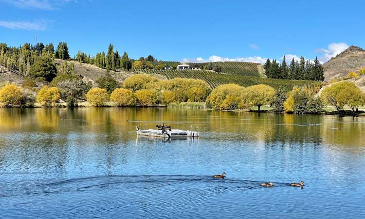
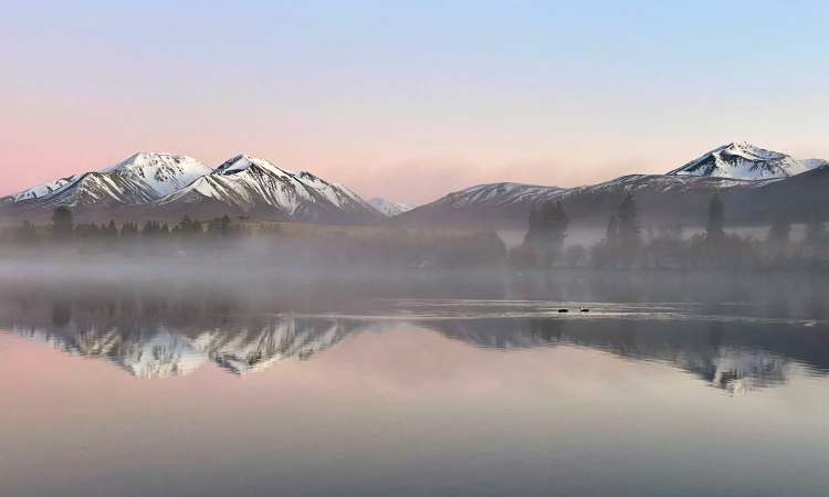
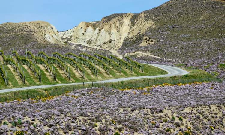
Central Otago: Containing the major towns of Alexandra, Cromwell, Roxburgh, Clyde and Ranfurly, there are also numerous smaller historic gold rush towns (e.g. Arrowtown and Ophir). The semi-arid region is known for breathtaking landscapes—from snow-capped mountains to rolling hills covered in vineyards and orchards (it’s the southernmost wine-growing region in the world, due to geography and a continental climate with hot summers and cold winters).
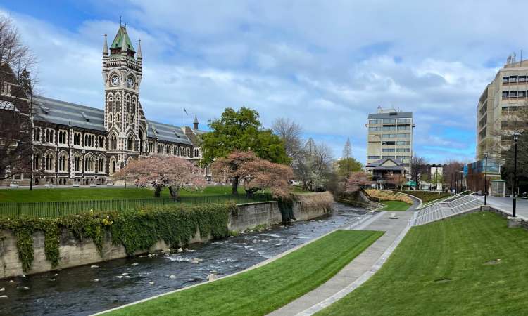
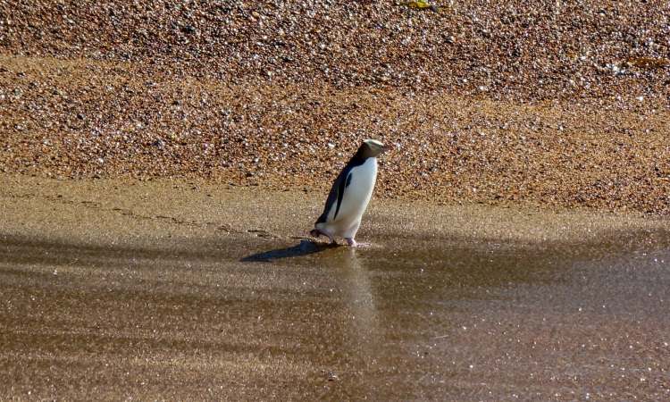
Dunedin: B studied in Dunedin, the principal city of the Otago region, known for its Scottish heritage, historic Victorian-era architecture, and vibrant student culture. The city boasts a thriving arts and culture scene, enthusiasm for sport (it’s mad about rugby) and is also known for its lively (student-related?) nightlife. Otago Peninsula, located just outside of the city, is home to several rare and endangered species such as the yellow-eyed penguin, New Zealand sea lion, and royal albatross.
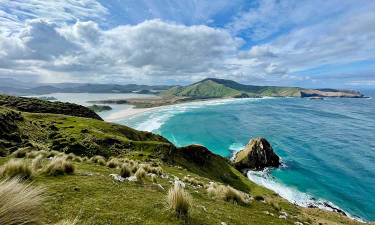
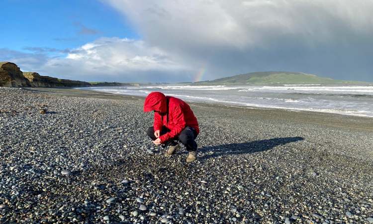
Coastal Otago: Ōamaru is the largest town (around 14,000 people) in the agricultural region of North Otago, known for its historic Victorian precinct and colonies of little blue and yellow-eyed penguins. Ōamaru is also the end point of the 301km Alps 2 Ocean Cycle Trail. The spherical Moeraki Boulders on Koekohe Beach are also a popular North Otago tourist attraction. Dominated by forests, hill country, and floodplains South Otago extends to the rugged coastline and forests of the Catlins. The main town of Balclutha has a population of around 4,000. Locals make a living from agriculture (especially sheep and dairy farming); visitors come for sights such as the Clutha River, Nugget Point Lighthouse, and the Catlins Forest Park.
Southland: The 30,000 square kilometre Southland region includes the natural attractions of Fiordland National Park (see below) and Stewart Island (see below). Rugged landscapes, pristine beaches, and diverse wildlife make it popular for hiking, fishing, and wildlife watching. The city of Invercargill is Southland’s largest urban centre, with dairy/ sheep farming and forestry being the main regional industries. Bluff, known for its oysters, is the southernmost town on the mainland, and is the departure point for ferries to Stewart Island.
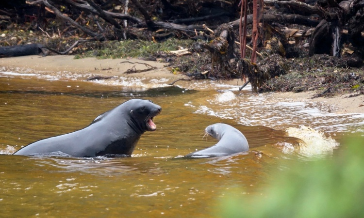
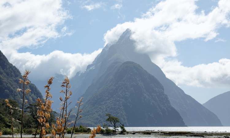
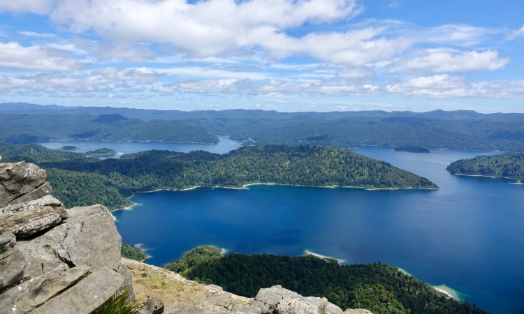
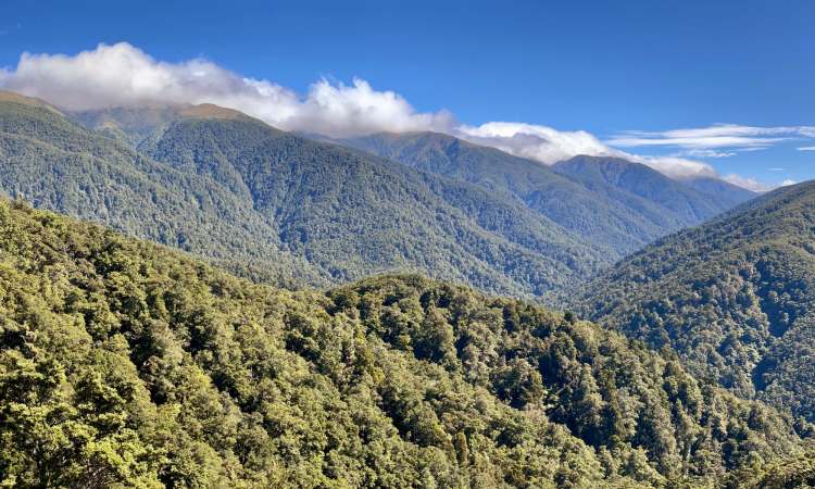
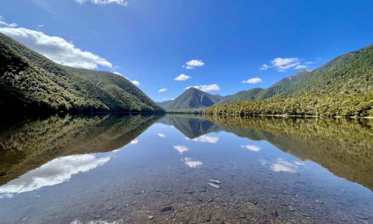
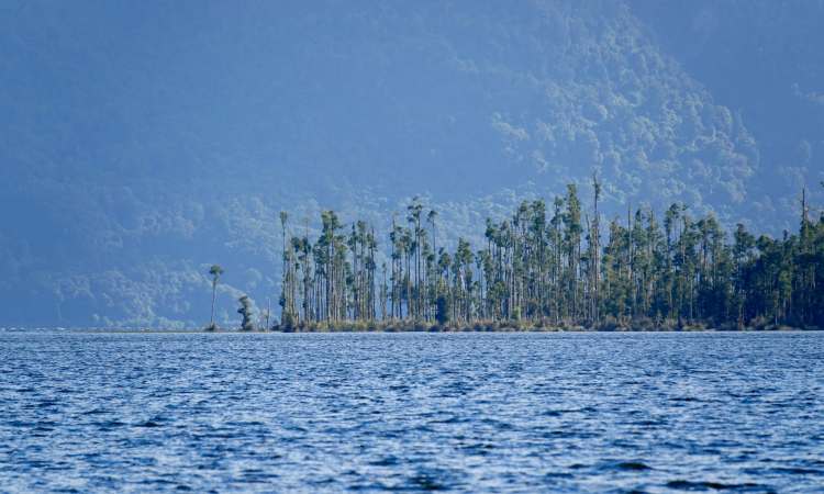
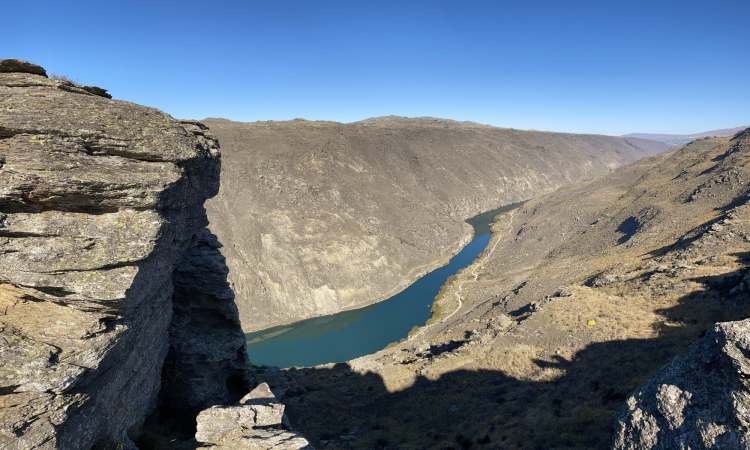
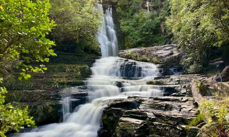
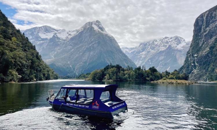
Fiordland: Occupying the westernmost third of Southland region, Fiordland encompasses over 1.2 million hectares of rugged mountains, virgin forests, lakes (including NZ’s three deepest: Hauroko, Manapouri, and Te Anau) and waterfalls. Milford Sound and Doubtful Sound are the most famous and accessible fiords; the world-renowned Milford Track is a popular draw. Like the West Coast’s Glacier Country, Fiordland is also part of the Te Wahipounamu World Heritage site, due to its natural beauty, geological significance, and rich cultural heritage. Wildlife found here includes native species such as the kea, takahē, and kākāpō, as well as populations of fur seals, penguins, and dolphins. It is remote (about 3 hours drive from Queenstown’s international airport) and relatively undeveloped, with scattered small townships including Te Anau—regarded as the gateway to Milford Sound and the start of the Milford Track. Some come for hunting and fishing; others for kayaking, heli-hiking and scenic cruises or flights.
Stewart Island: Known as Rakiura in Māori (meaning “glowing lights”) and officially part of Southland, this is NZ’s third-largest island and is located 30km across the Foveaux Strait; the island depends on fishing and summer tourism.
Join us on future away missions
Add our 📡 feed or enter your 📧 email for post notifications:
