Auckland wasn’t ready to let us go just yet. However, out west you could be forgiven for thinking that we were once more in the backcountry—taking gravel roads, passing quiet farms and dense forest, and encountering few people.
Coordinates
Waitākere Ranges
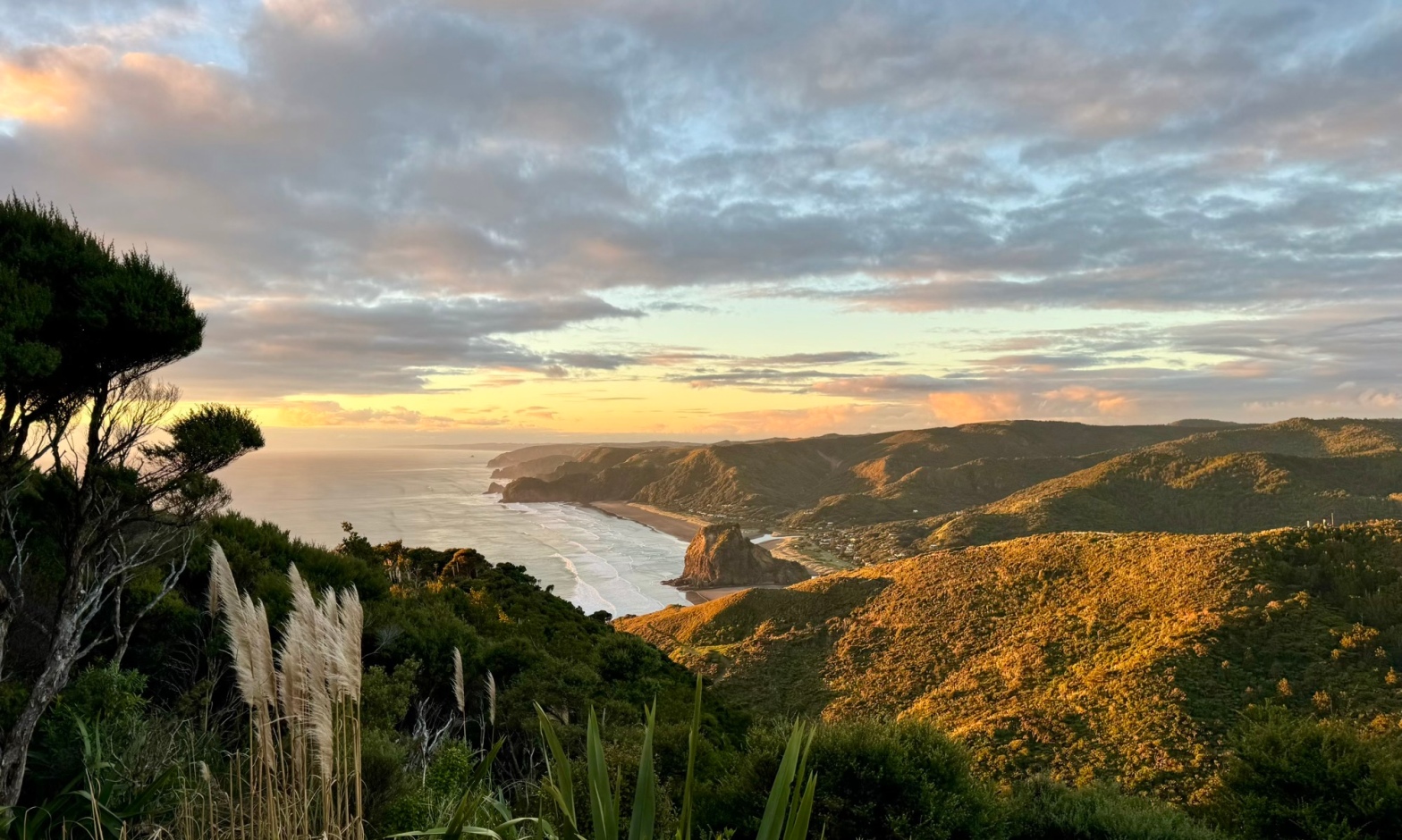
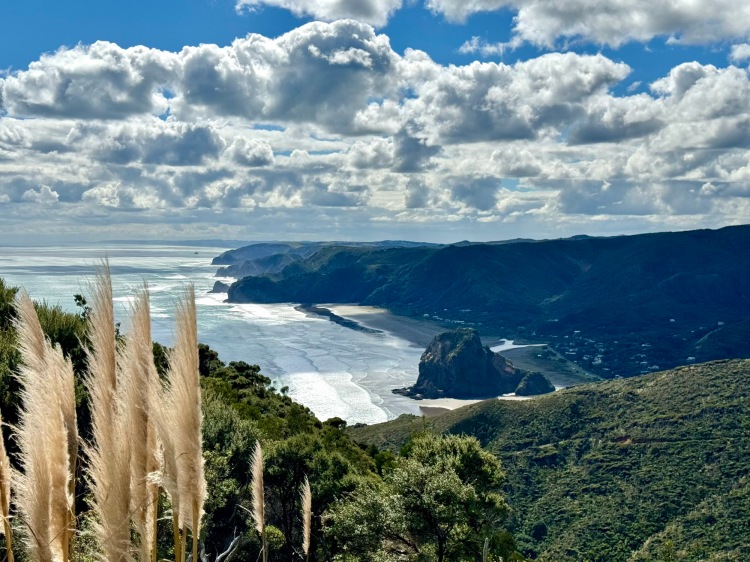
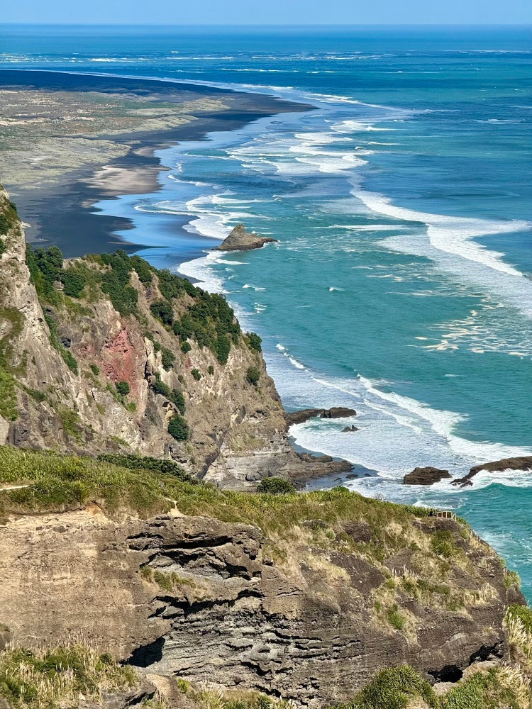
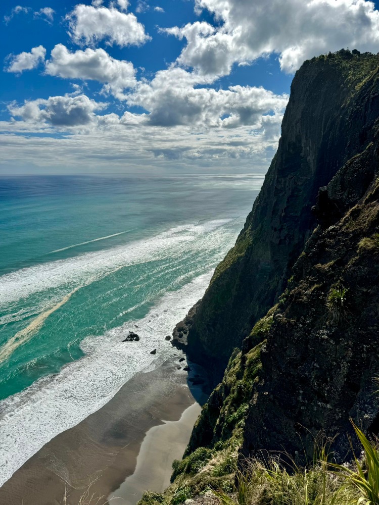
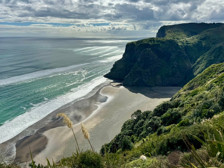
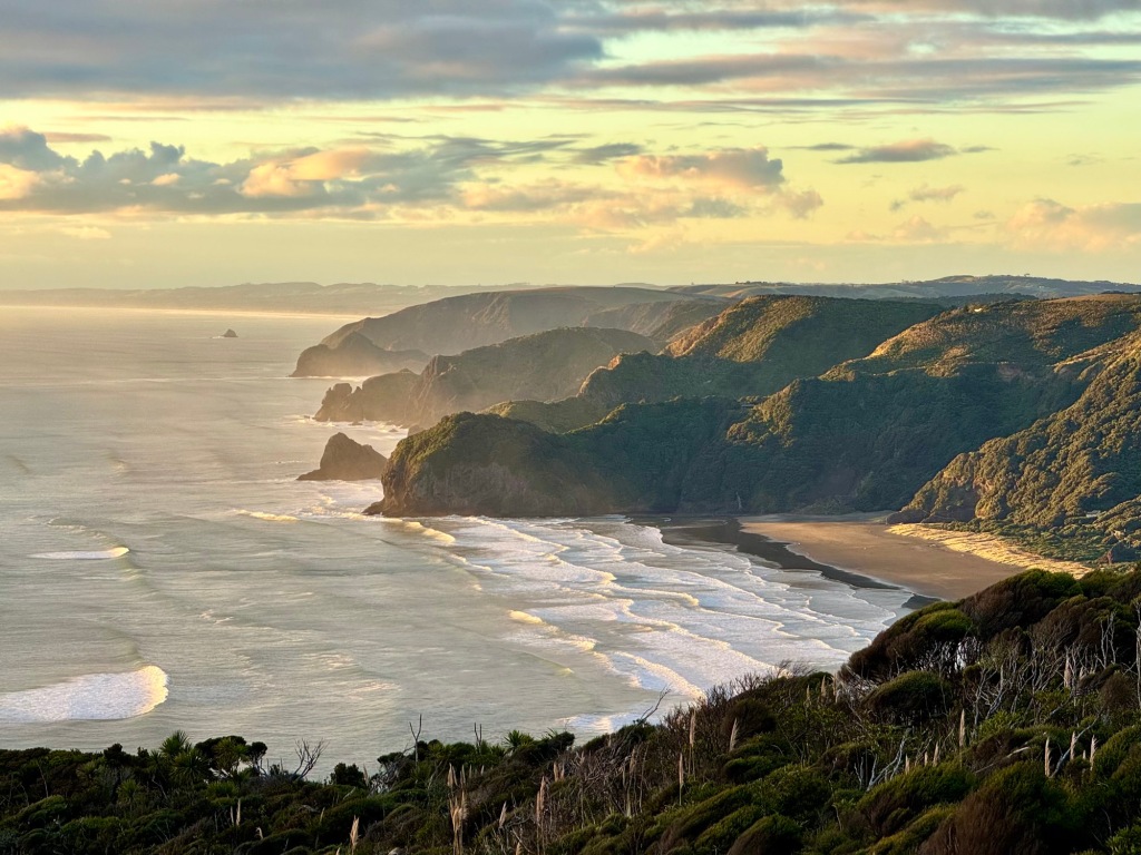
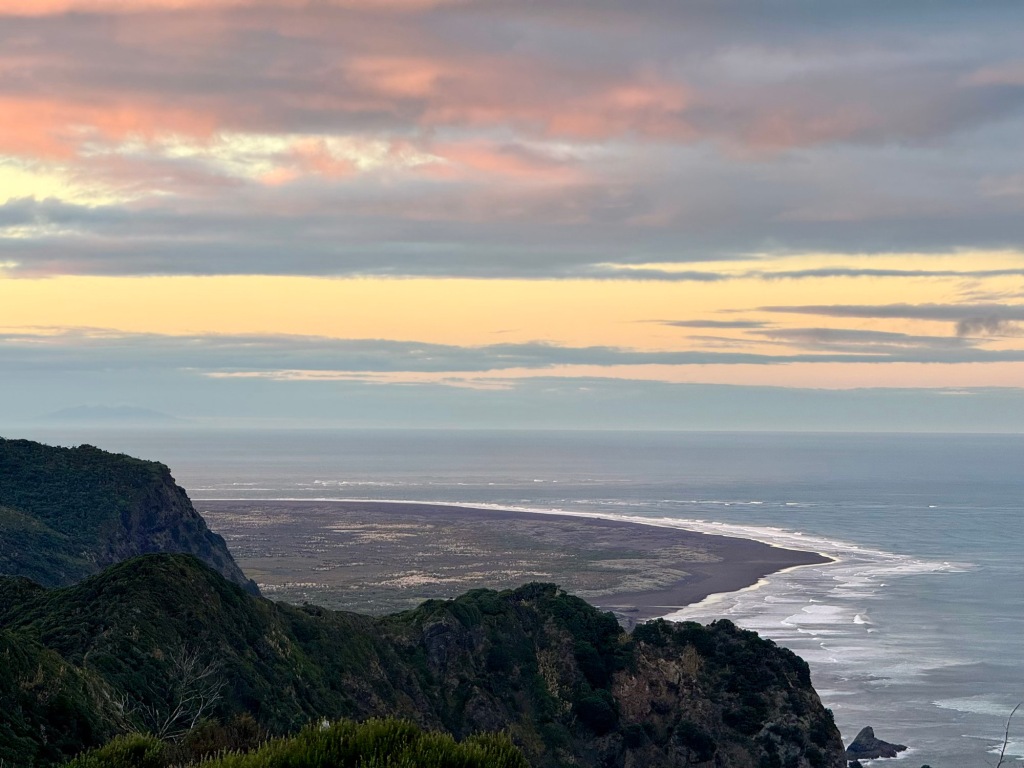
The Waitākere Ranges lie west of Auckland. Access to some roads/ tracks is still impacted by adverse weather events and by kauri dieback disease. There’s a view from Arataki Visitor Centre over Lower Nihotupu Reservoir and into Manukau Harbour (first photo). Mercer Bay Loop Track begins by overlooking Piha Beach (second photo) and continues to the site of Te Ahua Pā, a clifftop fortress (third photo). From the pā headland look back at the dramatic sea cliffs to the north (final photo).

Life at Te Ahua Pā.
🤔 Curiosity
An information panel at Te Ahua describes what life on the site of what may be NZ’s earliest pā (~1450CE) may have been like, based on archeological evidence and cultural interpretation:
People who lived here ate well and wide. Archeologists describe the midden as “bone rich”. They ate: fish (80% of the bones discovered were fish bones, mainly snapper, mackerel, kawhai); birds (mostly mutton birds); shellfish (green mussels, whelks and tuatua); and kumera (enough to require storage pits).
Stone flakes provide clues on activities that took place here and the techniques used for fashioning tools and equipment. We know: people living here had travelled or traded because there are stones from far-flung places (greywacke from Motutapu, argillite from Nelson and obsidian from Mayor Island); stone tools were used for cutting, sawing and scraping materials like flax, bone and wood; fish hooks were made of moa and sea mammal bone were shaped here. Most significant are signs that the technique for making fish hooks was changing—from Polynesian one-piece hooks towards the “Aotearoa-style” two-piece fish hooks.
[Te Kawerau ā Maki and Auckland Regional Council]
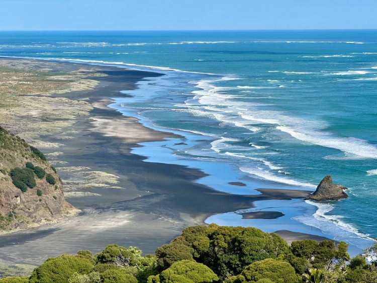
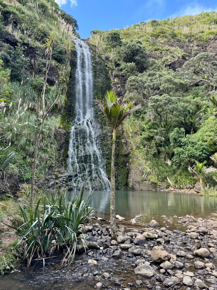
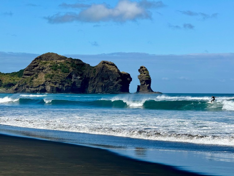
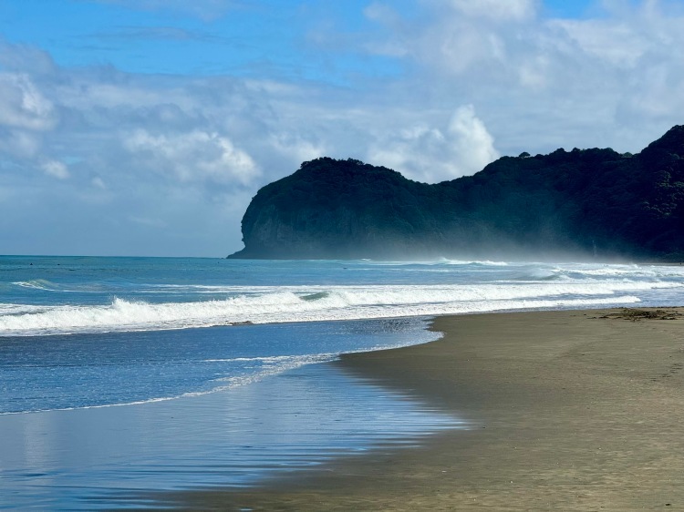
Comans Track links Mercer Bay Loop Track and Karekare. There are several views down to Te Unuhanga-a-Rangitoto | Mercer Bay, with Te Ahua Point and pā at its north end (first photo). The track also offers stunning elevated views over Karekare Beach (second photo). Descend into Karekare and a short way along Taraire Track find Karekare Falls (third photo). Of note, Karekare Beach featured in the 1993 film The Piano (final photo).
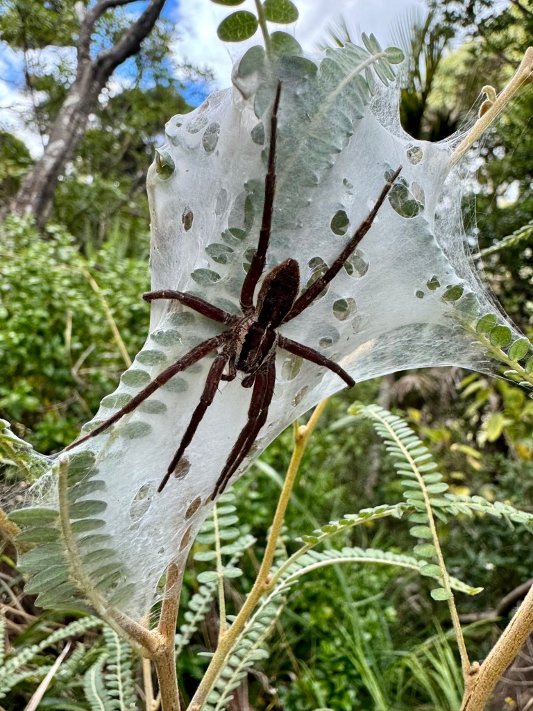
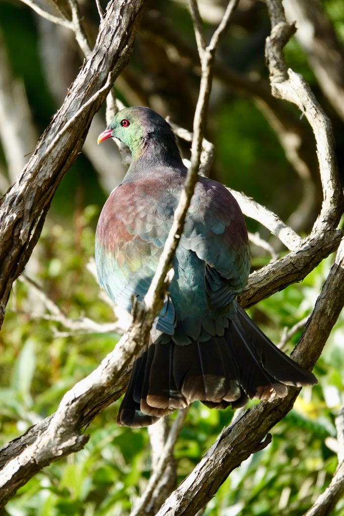
Along came a spider… a Dolomedes minor | nursery-web spider, which is endemic to NZ (first photo). Typically, only the white webs woven into low shrubs and containing young are seen, as the female nurses are nocturnal hunters (the web isn’t a trap). We also got a good look at the native Hemiphaga novaeseelandiae | | kerurū | NZ pigeon, which alighted noisily in our path (second photo). Both were seen on Comans Track.
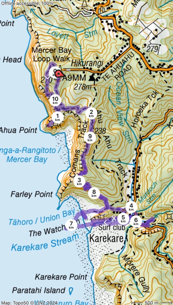
Here’s the GPS track of our 10.4km/ 3h 40min return walk:
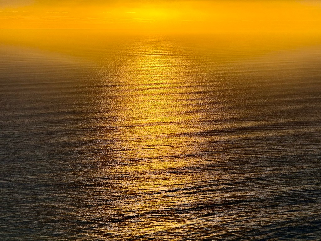
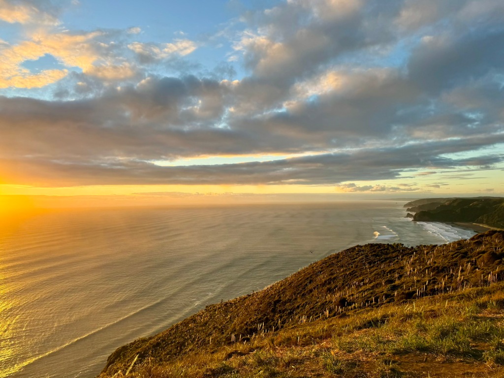
As we had parked over in Log Race CSC car park ($17/van), we were well-positioned to observe a Piha sunset:
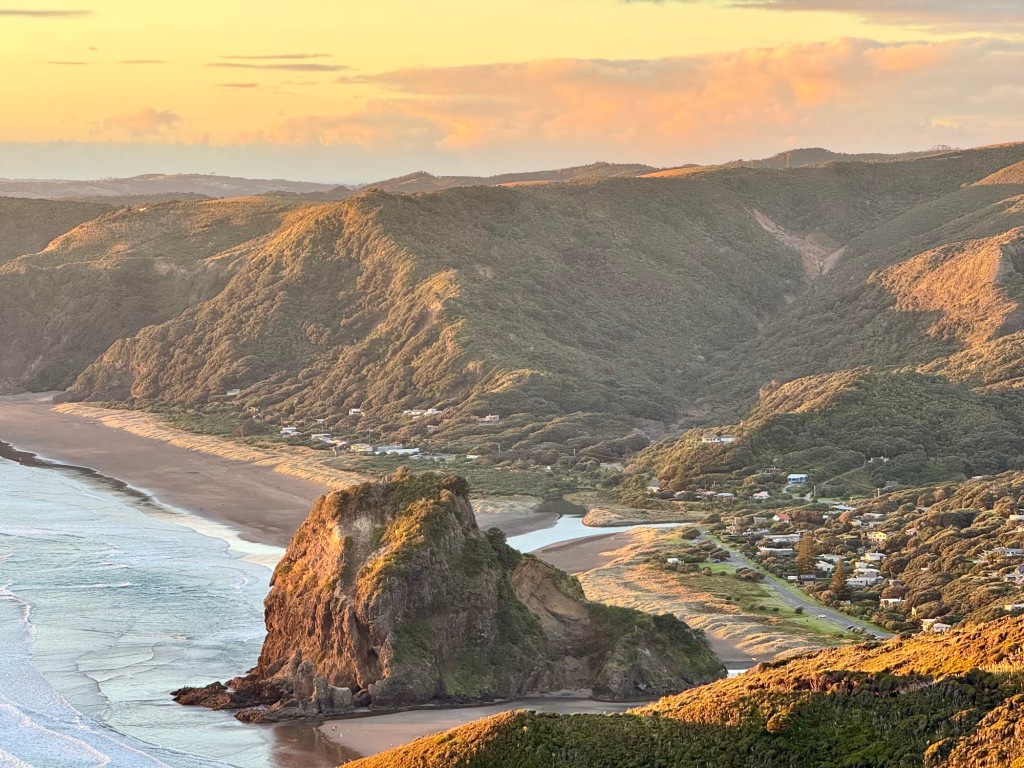
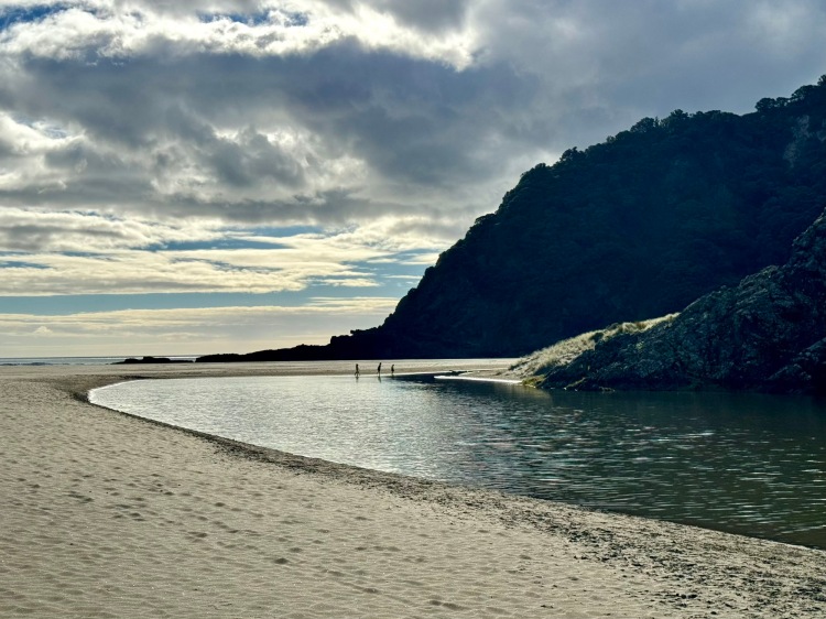
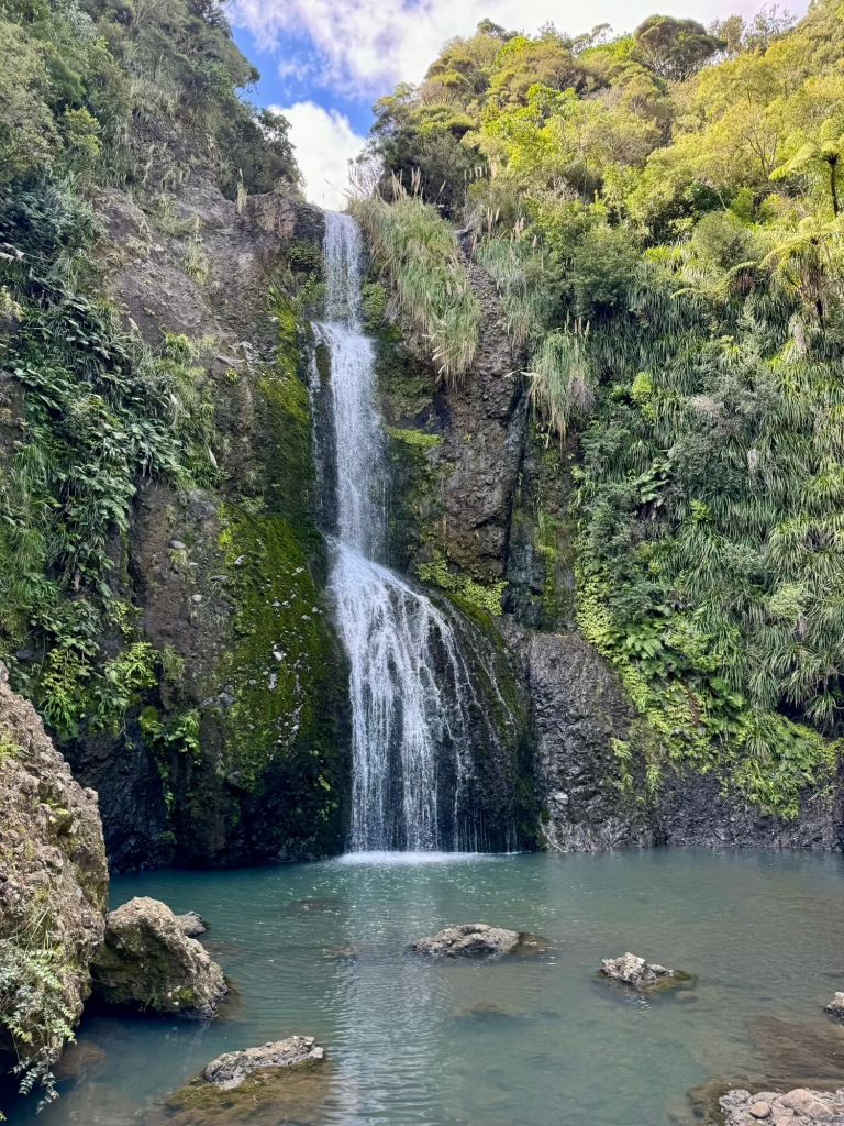
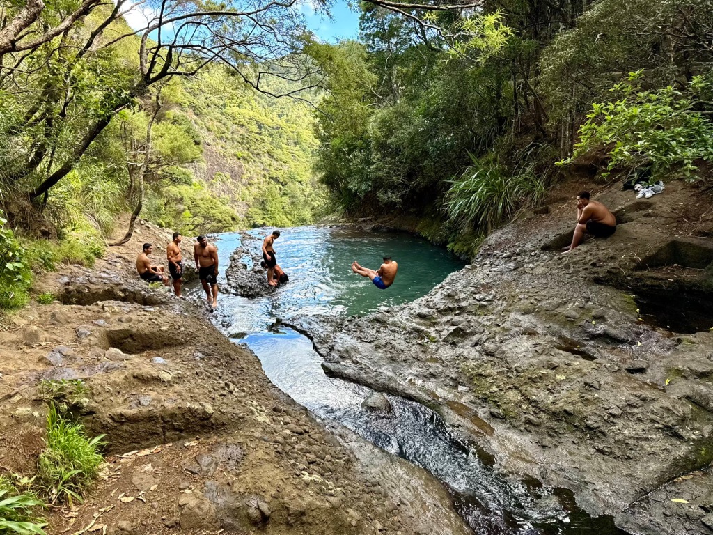
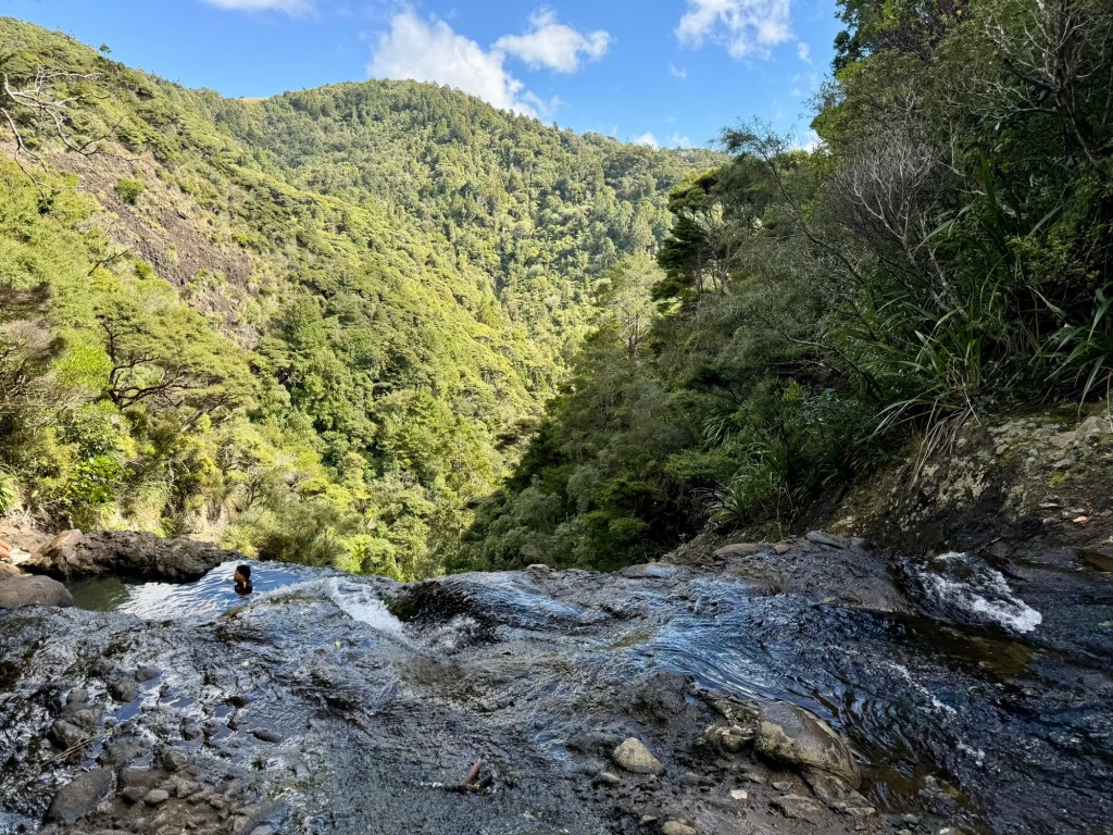
This also meant we had a dawn view of The Watchman, an outcrop jutting deep into Karekare Beach and also the site of a pā built ~1750CE (first photo). Accessed down the hill in Piha by walking up Glenesk Road (still closed to non-resident traffic) is the three-tier 40m Kitekite Falls (second photo). Above the falls, youths were manu back slap training in a large swimming hole—apparently seeking combination of style, splash size and acoustics (third photo)! Others preferred to simple chill in the infinity-edged smaller pool (final photo).
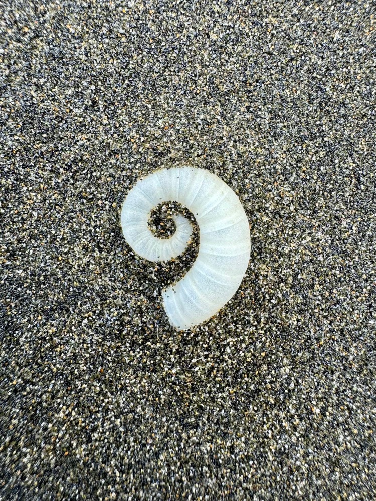
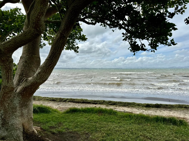
Te Piha is the Māori name for Lion Rock, which dominates Piha Beach; access to the overlook and pā site is closed (first photo). Today it’s a popular yet dangerous surf and swimming beach (second photo). It’s just over 2km from Lion Rock to the base of Te Waha Point at the north end of the beach, so ideal for a brisk stroll (third photo)! In the black ironsand you’ll find internal shells of Spirula spirula | ram’s horn squid in your path (final photo).
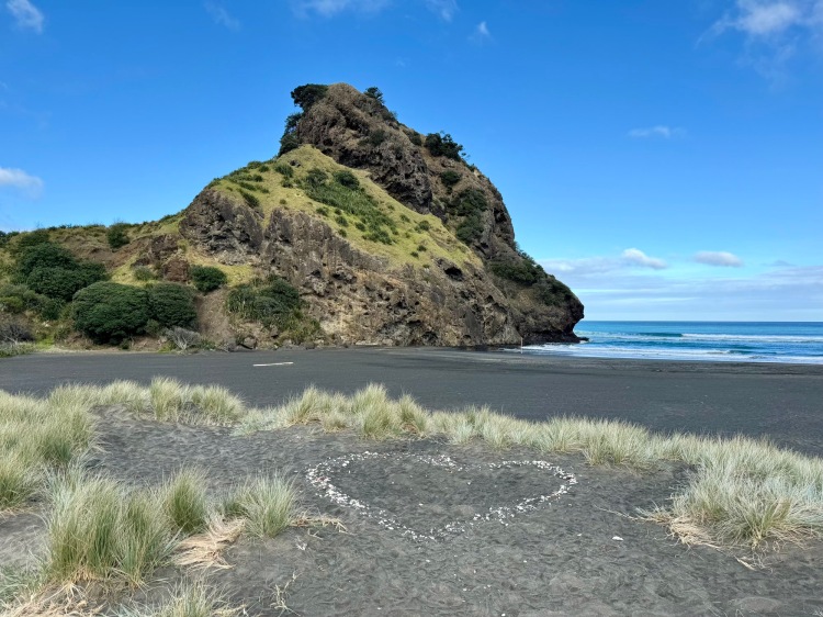
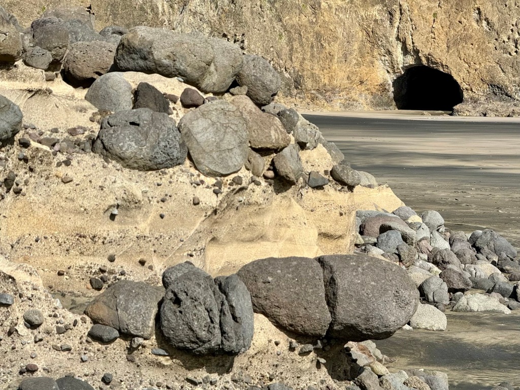
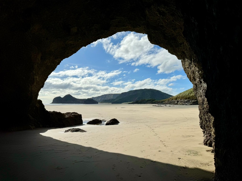
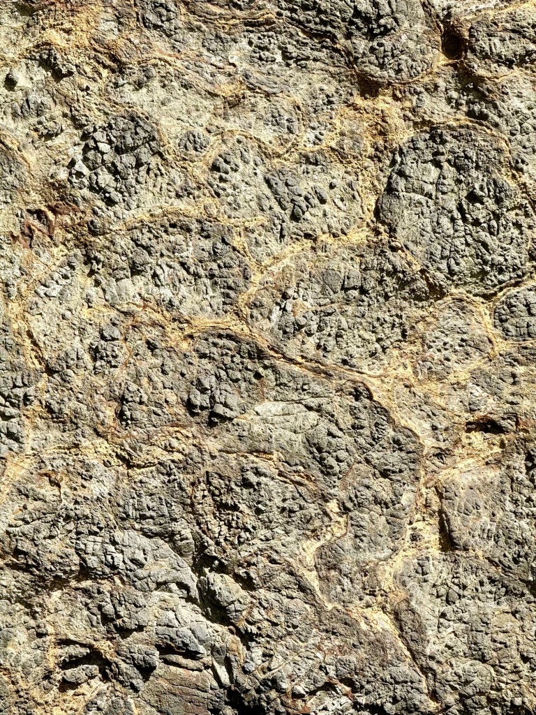
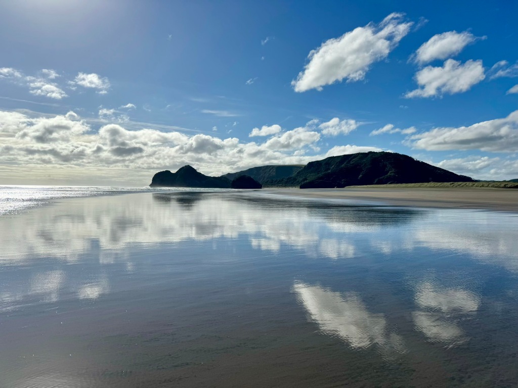
Te Henga | Bethells Beach, as much of the Waitākere Ranges, formed when the eastern edge of a giant volcano erupting 22–15 million years ago was uplifted 3–5 million years ago. Boulder-containing volcanic conglomerate is widespread (first photo). At the south end of the beach a large sea cave has eroded from a cliff made from undersea lava flows (second photo). Lava “pillows” are divided by orange glassy breccia (third photo). Black sand on the beach originates from Taupō and Taranaki volcanos (final photo).
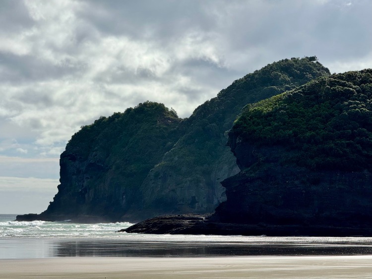
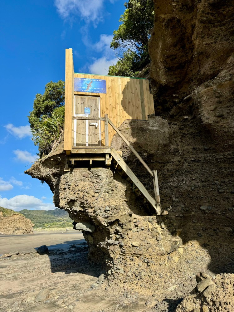
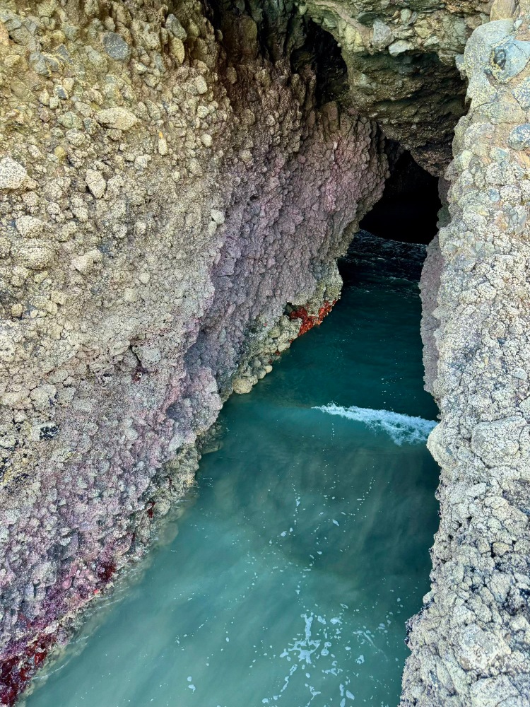
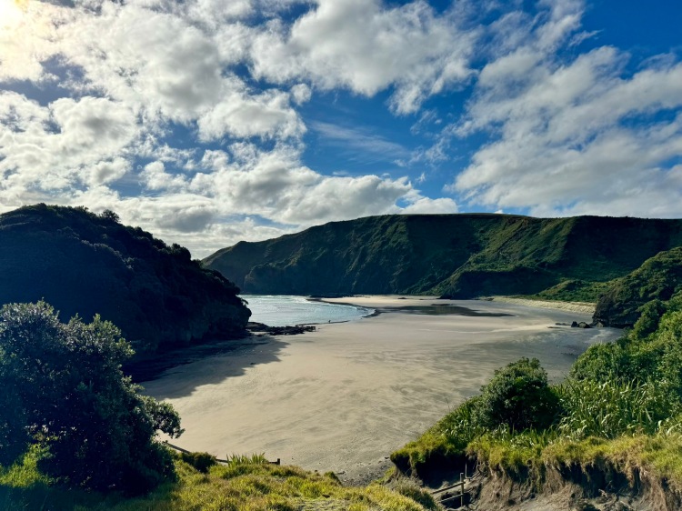
The north end of Te Henga | Bethells Beach is dominated by Ihumoana Island and Erangi Point, both of which contain former pā sites (first photo). Ihumoana is now a private bird sanctuary (second photo). Erangi Point contains a sea tunnel network (third photo). At the north end of O’Neill Bay, the remains of an explosion crater from a vent on the eastern flank of the Waitākare volcano, centred 20km offshore, can be seen in the cliffs (final photo).
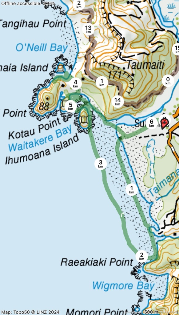
Here’s the GPS track of our 6km/ 2h beach exploration:
Unfortunately several points of interest were closed, including Te Henga Walkway, Lake Wainamu and Goldie Bush Walkway.
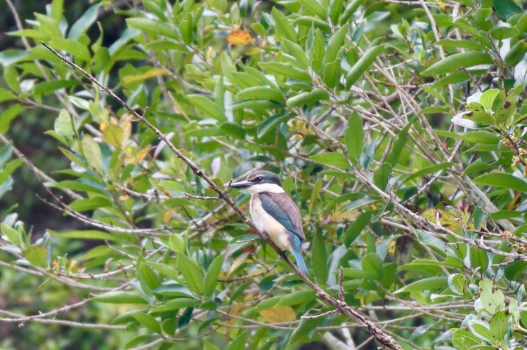
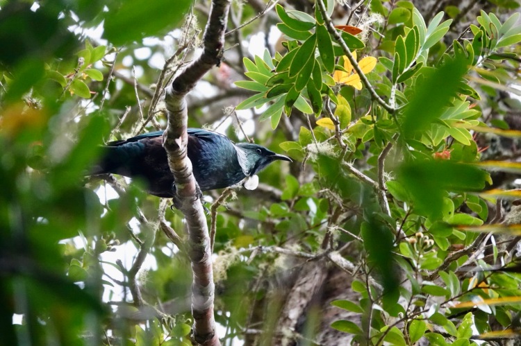
An advantage of spending the night in a reserve car park is waking to the dawn chorus. At Cascade Kauri CSC (end of Falls Rd; $17/van) in the Waitākere Ranges it was led by colourful, noisy and feral Platycercus eximius | eastern rosella—fast fliers, case in point (first photo)! On Lower Te Piringa Track we also saw Todiramphus sanctus | kōtare (second photo) and Prosthemadera novaeseelandiae | tūī (third photo). There are some fine kauri trees along the trail, too (final photo).
Kaipara Harbour
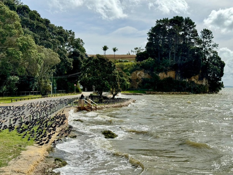
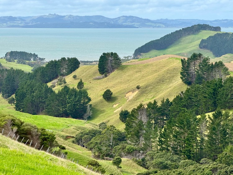
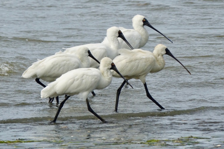
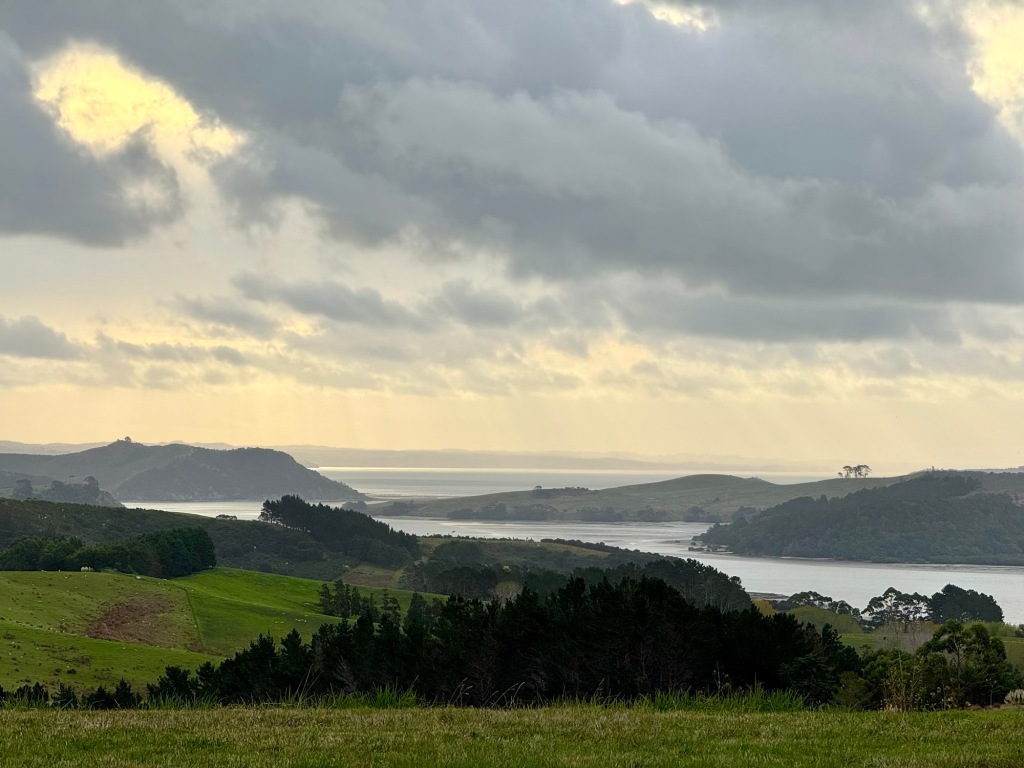
Despite the lack of any park-over options or services, we drove out onto the Te Korowai-o-Te-Tonga Peninsula | Kaipara South Head. First we stopped at the geothermal Parakai Springs near Helensville, which were rather run down. At Shelly Beach oystercatchers staged a mass demonstration, with a road block over lost beachfront roosting rights (first photo). Further out we had a view over Te Rau Pūriri Regional Park, a working farm, into Kaipara Harbour (second photo). Seagrass piles had formed on the beach at Ōmokoiti Bay (third photo); Platalea regia | royal spoonbill waded here (final photo).
We enjoyed the evening light from Ātiu Creek CSC near Tapora, before wet weather arrived:
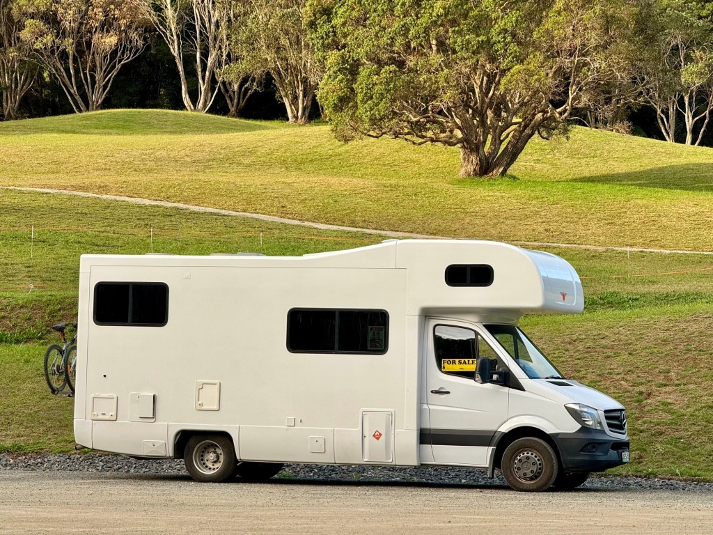
Escaping incoming bad weather, we retreated further north to prepare ourselves and Curiosity for a last trip into the Far North—and to begin getting the van ready for sale.
Join us on future away missions
Add our 📡 feed or enter your 📧 email for post notifications:
